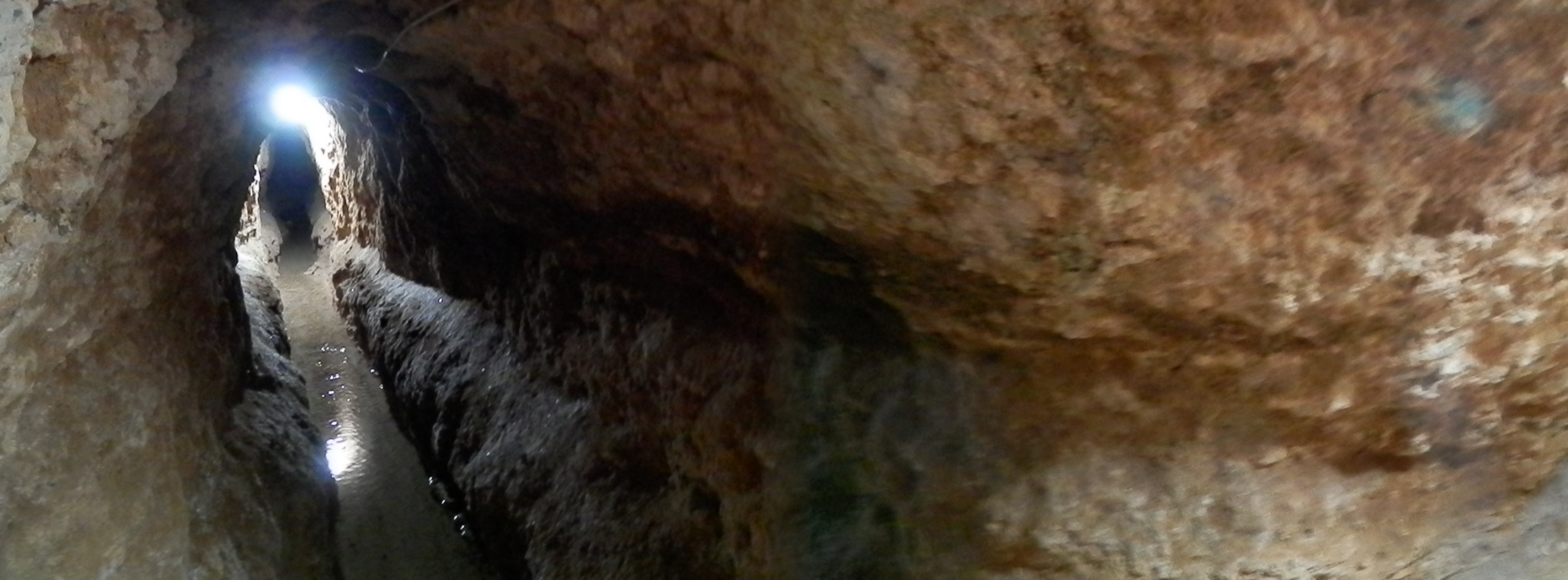
A narrow strip of water disappears into a dark tunnel. The ceiling sits close above it, and a small patch of daylight offers the only obvious connection to the surface. This is a qanat in Iran: part of a water system whose most important route can remain almost entirely out of sight. 1
The photograph was taken in 2012 near Nain, in Isfahan Province. It shows the confined interior of one tunnel, rather than a complete map of the system. Even that limited view supplies the central surprise. A waterway does not need to be an open river, and a useful flow does not always begin with a motor.
The route provides the energy
A qanat collects groundwater at a higher elevation and brings it toward a lower outlet along a gently descending underground passage. Gravity supplies the movement. UNESCO’s description of the Persian Qanat explains how a main well reaches the aquifer while a near-horizontal tunnel carries water toward the places that use it. 1
The important word is gently. A tunnel can look nearly level to a visitor while still having enough fall to guide water along its length. Imagine following the waterline rather than judging the floor by eye: the overall change in elevation matters more than whether a short section looks dramatic.
That makes the absence of a spectacular moving machine part of the attraction. The engineering has been placed in the route itself. The photograph’s dark opening is not a view of the original survey or excavation, but it helps make their purpose tangible: a carefully chosen path can do continuing work.
The holes above are working entrances
Vertical shafts connect the tunnel to the surface. UNESCO’s technical account explains their roles in removing excavated material, providing ventilation and allowing maintenance. Seen from above, the openings can form a line across a landscape, marking a watercourse that would otherwise be difficult to recognize. 1
An evaluation prepared for the World Heritage nomination describes the qanat as more than a single tunnel. The protected systems include associated wells, reservoirs and other structures, linked to the settlements and cultivation they support. The underground passage belongs to a wider arrangement of collection, delivery and use. 2
The view from inside reverses the usual way of looking at infrastructure. On a road, the route is laid out in front of you. Here, the visible section is a fragment of a system whose users and access points may be above or far beyond the frame.
A shared supply needs shared knowledge
UNESCO’s inscription decision recognizes communal management alongside the physical works. Water must be distributed and the passage kept functioning; a successful tunnel alone does not settle every question about who receives the resource. Engineering and cooperation appear together in the heritage being preserved. 3
The eleven systems in the World Heritage property represent particular Iranian examples. The photograph illustrates the broader qanat tradition and is not presented as proof that this tunnel belongs to one of those eleven sites.
Look back at the low passage and its narrow stream. Much of the effort that makes the scene possible is absent from the photograph: finding the source, setting the route, removing earth and returning to maintain it. The quiet flow is the visible result of that larger, mostly hidden undertaking.